ELCOVISION 10 CAD Plugins
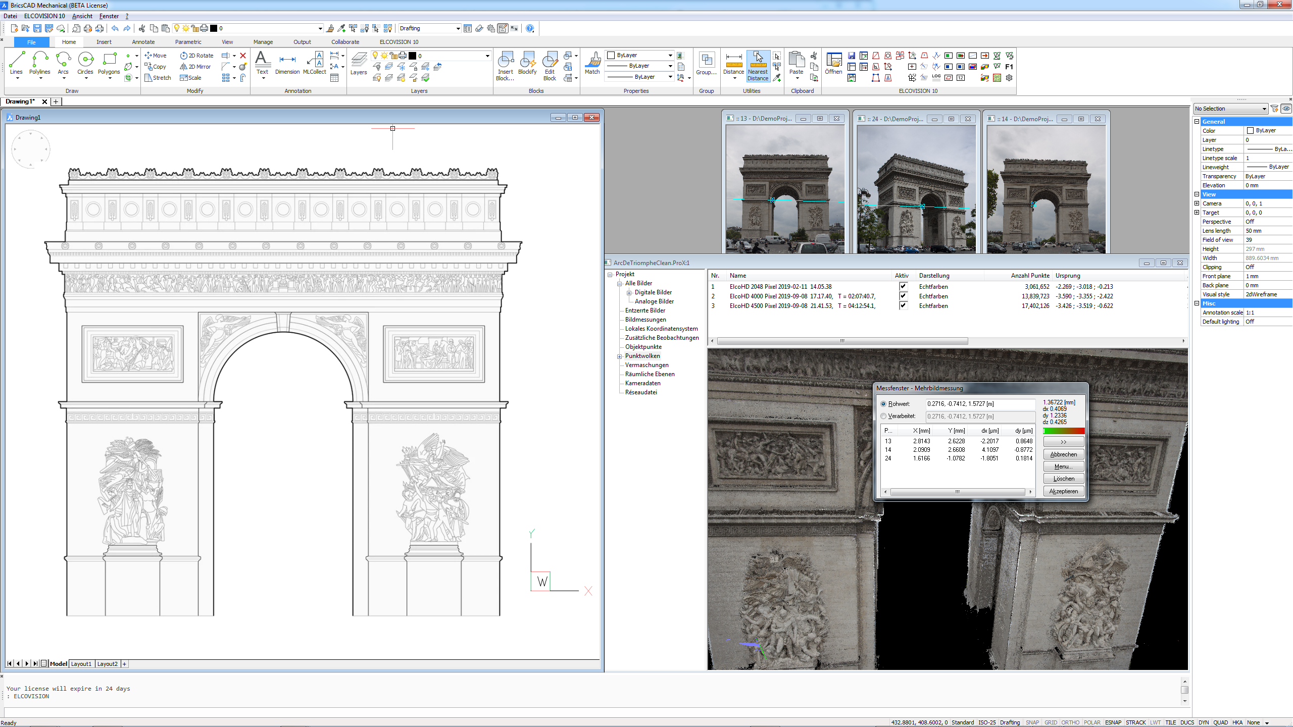

ELCOVISION 10 is seamlessly integrated into AutoCAD and BricsCAD. All drawing commands of the CAD program become "measurement commands". This means, for example, that each drawing command such as "Line" is drawn directly with the coordinates from image measurements.
Thus these CAD systems become powerful Photogrammetric evaluation programs. In BricsCAD V19 and newer, point clouds generated by ELCOVISION 10 from images can also be imported into the drawing with a few mouse clicks and further processed there.

Since most CAD programs are optimised for designing objects rather than reconstructing them, ELCOVISION 10's CAD plugins provide numerous additional drawing functions optimised for measurement, such as automatic line measurement and 3D trimming, measurement of rectangles, arcs, ellipses directly over 3D points, etc:
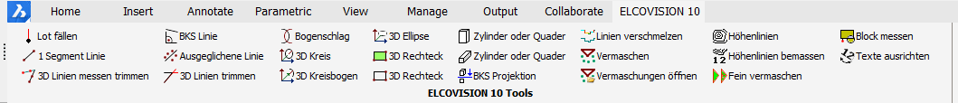
ELCOVISION 10 is completely integrated into AutoCAD and BricsCAD, all CAD drawing functions can be supplied with measurements, plus the following functions are available:
- Superimposition of a CAD drawing into digital images
- Measuring and drawing perpendiculars with one measurement
- Measuring and drawing of 1 segment lines
- True 3D trimming of lines
- Simultaneous measurement and drawing of 3D trimmed lines
- Measure and draw 3D balanced lines
- Measurement and drawing of lines aligned with the UCS
- Arc stroke function
- Direct measurement and drawing of 3D circles and circular arcs over 3 3D points with plausibility check
- Direct measurement and drawing of 3D rectangles over 3 3D points with plausibility check
- 2D projection of a drawing on any plane
- Optimized merging of single lines to 2D polylines and 3D polylines
- Integrated 3D surface modeller
- Generate waterproof surfaces from 3D point clouds and 3D line drawings.
- Create contour lines from surface models
- Direct measurement and insertion of blocks with automatic block alignment
- Direct measurement and insertion of cylinders and cuboids
- Automatic rectification of images into the drawing
- Automatic insertion of orthophotos into the drawing
- Starting with BricsCAD V19: Direct insertion of the generated point clouds into the drawing.