ELCOVISION 10 - The leading 3D photogrammetry software for fully automated 3D object reconstruction from images.

Since its market launch in 1986 as the world's first 3D photogrammetry system for PCs, ELCOVISION 10 has presented many groundbreaking innovations in the automatic 3D evaluation of images, such as in 2005 as the first 3D photogrammetry system with fully automatic image orientation for freehand images.
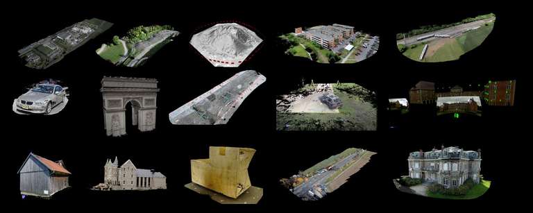
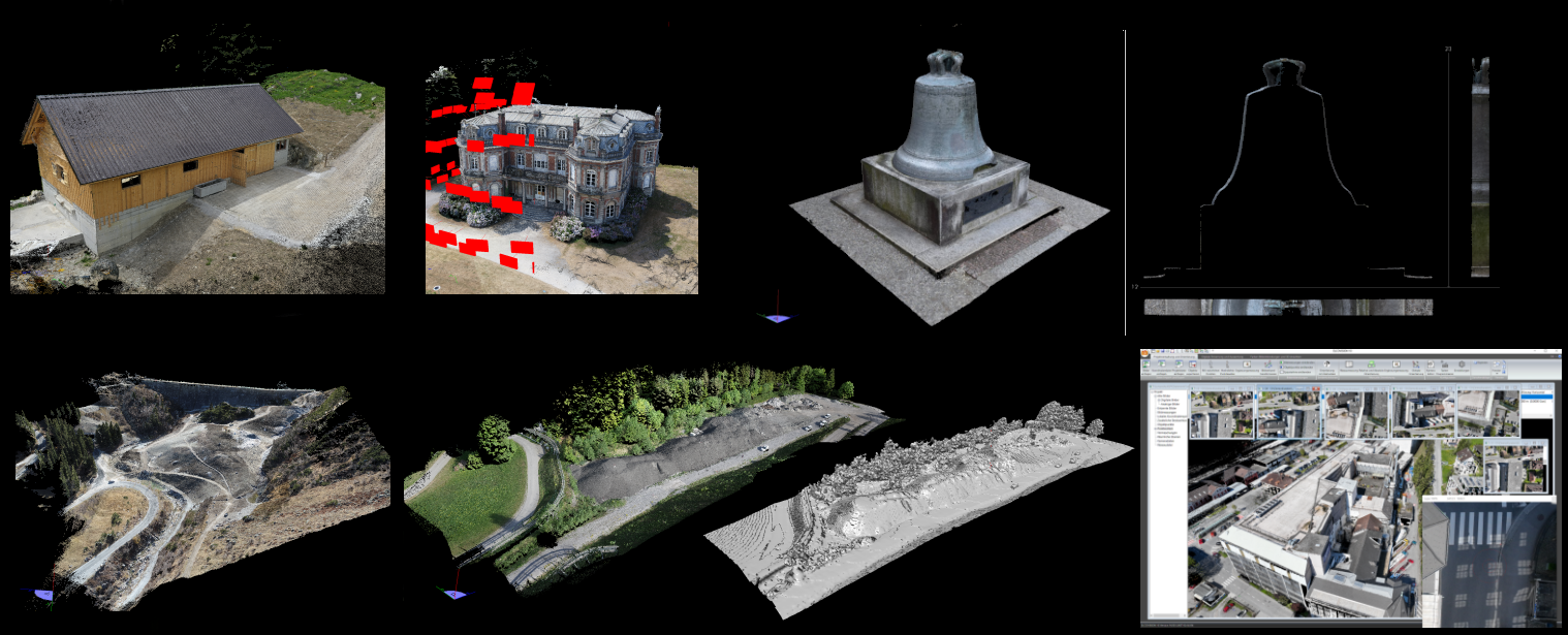
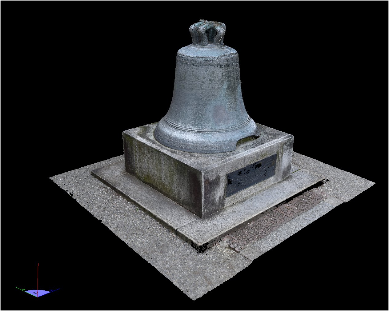
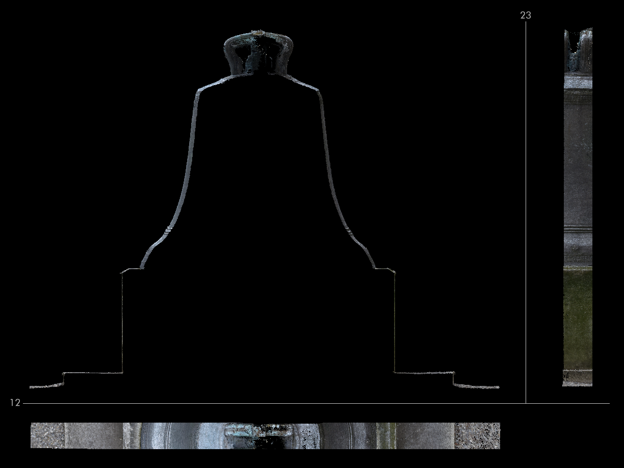
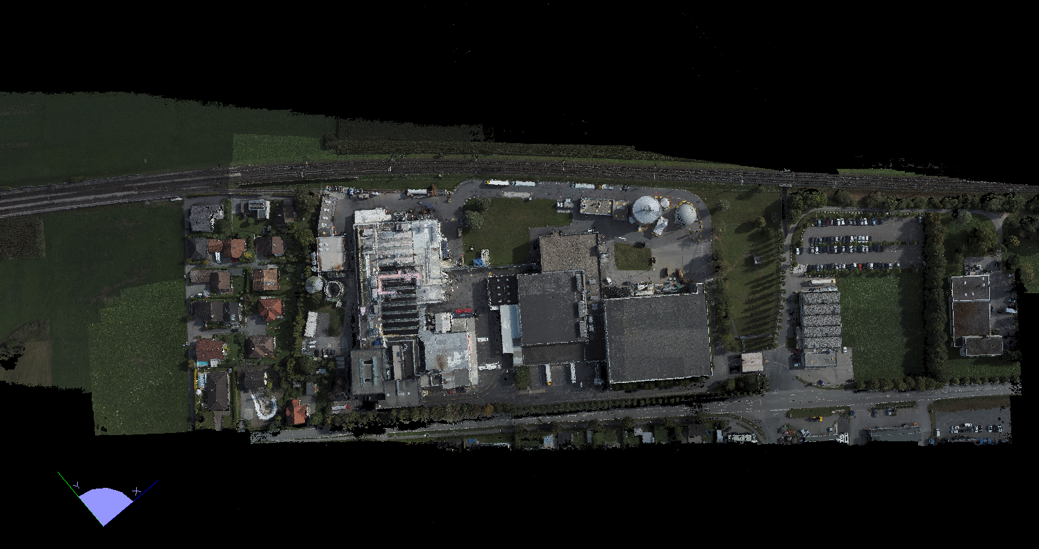
Now ELCOVISION 10 shows another innovation: the fully automatic generation of high-density point clouds from images in almost laser scan quality. Even with surfaces that are almost homogeneous in terms of colour, the smallest texture differences on the object are sufficient to generate almost noise-free 3D point clouds. You can now model even difficult cases such as interiors, cars or metal surfaces in 3D:
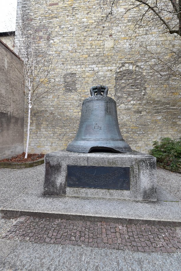
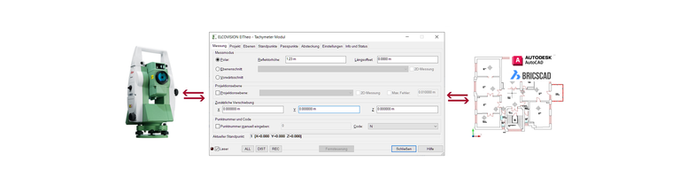
Photograph the object with any high-quality camera. You can use any camera with normal or fisheye lenses, even mobile phone cameras can deliver good results. If you are using a stereo camera such as the Leica BLK3D, you will automatically have a correctly scaled and orientated photo block.
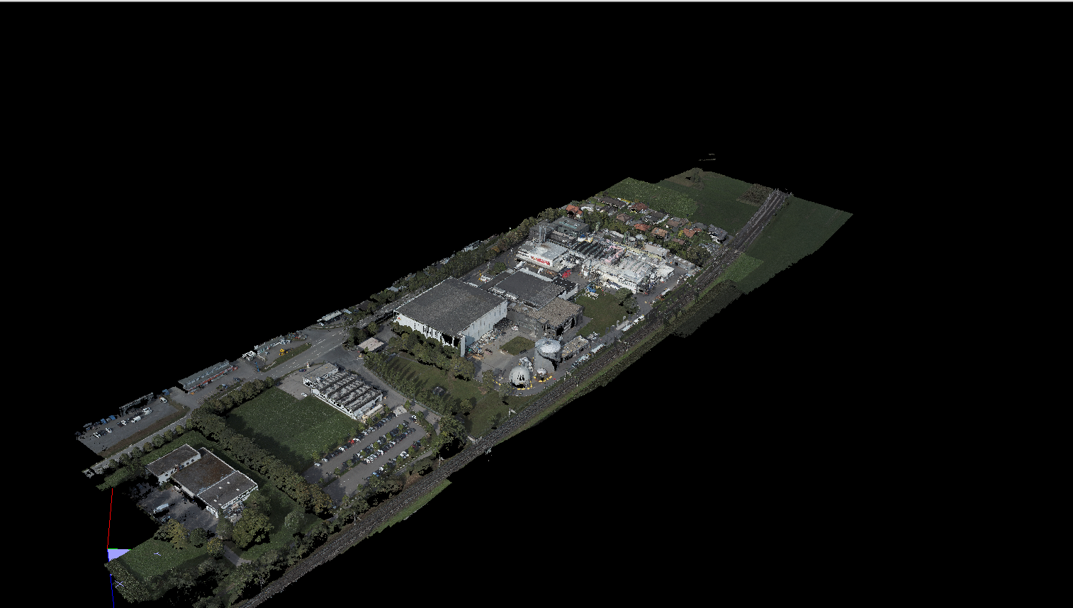
Take photos by hand, with a tripod, aerial photos of drones or from airplanes, ELCOVISION 10 processes all images, the only condition is that you have enough image overlap and the images have a reasonably good quality.
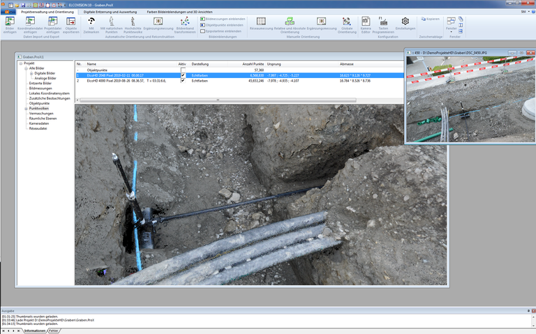
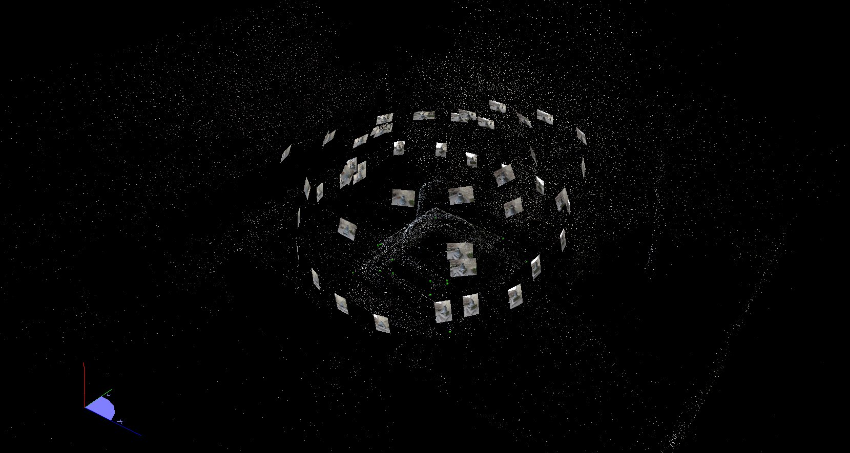
These images are then simply imported into ELCOVISION 10. The software then analyses the images and automatically calculates the so-called image orientation, calibrates the camera(s) and, if desired, calculates a high-density point cloud of the object itself.
As a user, you only have to define the desired system of coordinates and then the results can be read directly into a CAD or exported to other applications.
The biggest strengths of ELCOVISION 10 are:
Up to 30° convergence angle (shooting angle) between two shots.
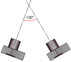
This will give you much more reserve if the pictures are not taken well enough: The automatic image orientation works even in cases that used to be only manually orientable. If you have even larger convergence angles between 2 images, or if you have an extremely poor image quality, you can also orient the images manually to the photo block, here convergence angles between 2 images of up to 170° are possible without problems.
Very fast, fully automatic orientation with simultaneous calibration of any number of cameras.
Up to 2000 images per hour are oriented on current computers. Theoretically you could take each image with a different camera and lens and each image is calibrated during orientation. Nevertheless, if possible, only a few different non calibrated cameras should be used for one object. This makes the camera calibration much more stable and the accuracy much better.
If you use calibrated cameras, the point accuracies will be 2-4 times better. The highest accuracies are achieved with calibrated fixed focal length lenses, at natural points ELCOVISION 10 achieves accuracies of up to 0.7*[pixel size at object]. If points are additionally signalled with ELCOVISION 10 Targets, you will achieve point accuracies of up to 0.01*[pixel size on object].
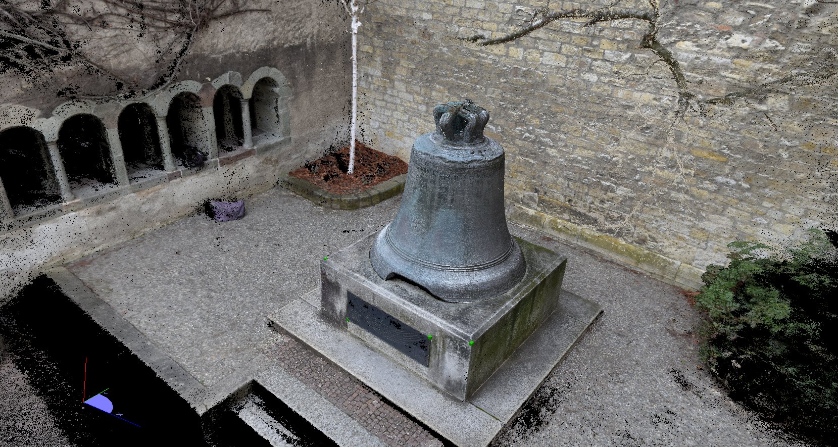
Fully automatic generation of highly detailed, almost noise-free point clouds from the images.
ELCOVISION 10 uses a new algorithm which makes it possible to calculate a 3D point from every pixel of an image. Each 3D point is the result of a so-called forward cut, so ELCOVISION 10 has very good control over this process and can generate point clouds in almost laser scan quality. Even the reconstruction of facades from aerial photographs taken almost vertically downwards is now possible even though these show the facades only in very steep views or only at the edges of the image.:

Transformation of the photo block into the desired system of coordinates
For the ready oriented photo block there are then a number of possibilities to transform it into the desired coordinate system: Whether a local coordinate system with at least one known distance, 4 or more control points, or using GPS coordinates in the images: You have full freedom.
Further Processing Options
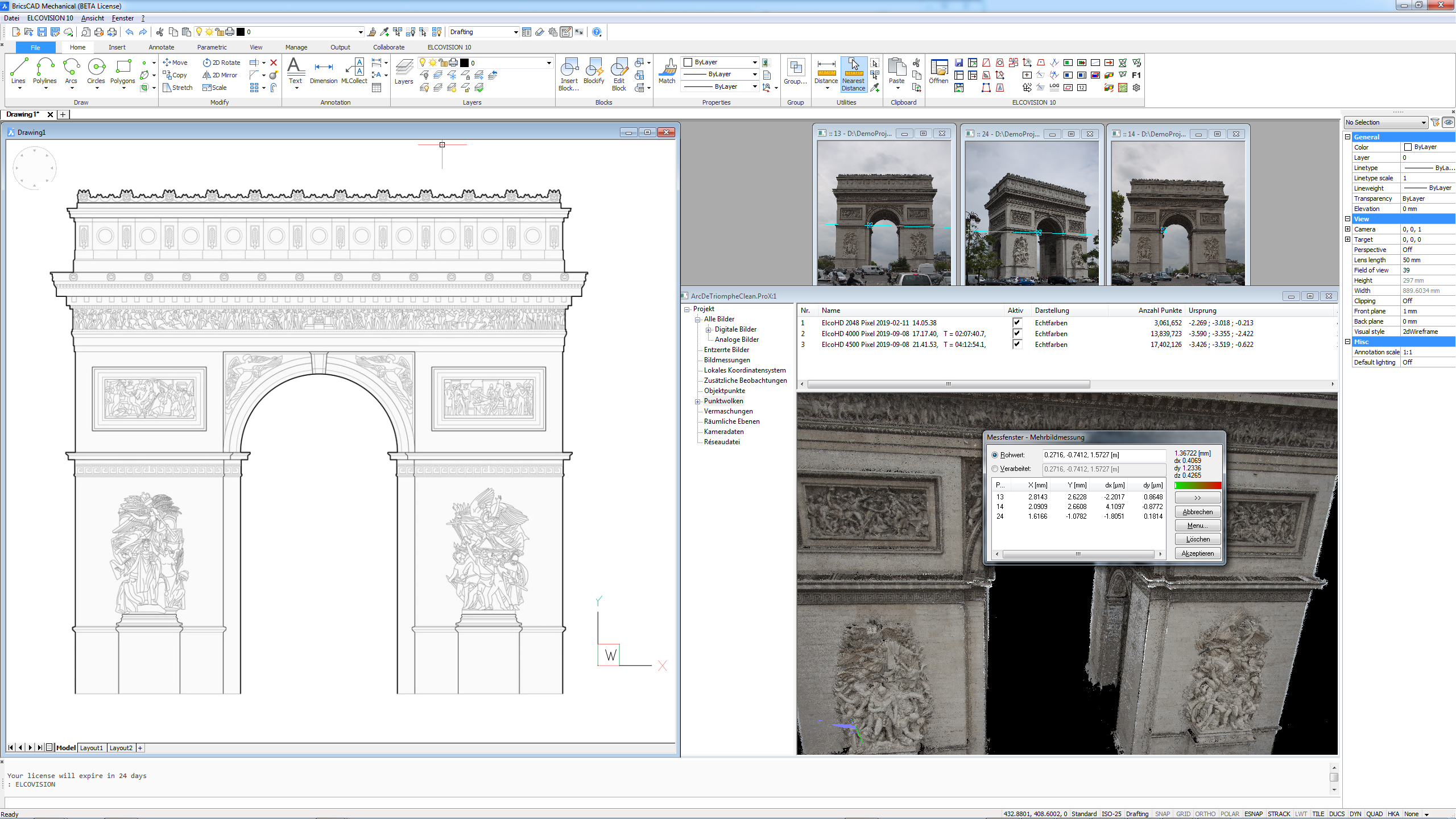
In the orientation module itself you can now perform area calculations, volume calculations or simple distance measurements. You can create Orthophotos and you can export the point clouds in different formats.
CAD Plugins for AutoCAD and BricsCAD
Test ELCOVISION 10 by yourself: Get the demo version here. We would also be happy to demonstrate the software to you in a demo, for an online demonstration please contact us here, or visit us at one of our next events.
Here you will also find numerous sample projects, in each case just the images to compute them by yourself, and you will find also the finished oriented projects and their point clouds.
ELCOVISION 10 Overview of Functions
Supported cameras, capture configuration
- All currently commercially available digital cameras. The higher the quality of the camera/lens combination, the better the images and the better the results. Even cameras from mobile phones give usable results.
- All types of lenses are supported: "normal" lenses, fisheye lenses and macro lenses.
- Stereo cameras such as the Leica BLK3D: The well-known stereo base is used directly for scaling the photo block, the position sensors of the Leica BLK3D are used to correctly align the photo block
- Analog metric cameras with réseau plates from Leica, Hasselblad, Rollei, Pentax, etc.
- Images can be taken freehand, on tripods, from air and underwater.
Image Recognition and Image Processing
- Reads and writes almost all currently known image formats:
.3fr, .8bim, .8bimtext, .8bimwtext, .app1, .app1, .jpeg, .art, .arw, .avs, .bie, .bigtiff, .bmp, .bmp2, .bmp3, .brf, .cache, .cals, .caption, .cin, .clipboard, .cmyk, .cmyka, .cr2, .crw, .cur, .cut, .dcm, .dcr, .dcx, .dng, .dps, .dpx, .emf, .epdf, .epi, .eps, .eps2, .eps3, .epsf, .epsi, .ept, .ept2, .ept3, .erf, .fax, .fits, .fpx, .fractal, .gif, .gif87, .gradient, .gray, .graya, .histogram, .hrz, .icb, .icc, .icm, .ico, .icon, .identity, ,image, .info, .iptc, .iptctext, .iptcwtext, .isobrl, .isobrl6, .jbg, .jbig, .jng, .jnx, .jpeg, .jpg, .k25, .kdc, .label, .m2v, .mac, .map, .mat, .matte, .mef, .miff, .mng, .mono, .mpc, .mpeg, .mpg, .mrw, .msl, .mtv, .mvg, .nef, .orf, .otb, .p7, .pal, .palm, .pam, .pbm, .pcd, .pcds, .pcl, .pct, .pcx, .pdb, .pdf, .pef, .pfa, .pfb, .pgm, .picon, .pict, .pix, .plasma, .png, .png00, .png24, .png32, .png48, .png64, .png8, .pnm, .ppm, .preview, .ps, .ps2, .ps3, .ptif, .pwp, .raf, .ras, .rgb, .rgba, .rla, .rle, .sct, .sfw, .sgi, .sr2, .srf, .stegano, .sun, .svg, .svgz, .text, .tga, .tiff, .tile, .tim, .topol, .ttf, .txt, .ubrl, .ubrl6, .uil, .uyvy, .vda, .vicar, .vid, .viff, .vst, .wbmp, .webp, .wmf, .wmfwin32, .wpg, .x3f, .xbm, .xc, .xcf, .xmp, .xpm, .xv, .xwd, .yuv - Built-in image processing with contrast enhancement, gamma correction, etc.
Réseau Measurement
- Fully automatic réseau measurement of réseau images from analog metric cameras.
Orientation Methods
- Fully automatic image orientation if convergence angle <30° and image overlap >65% with currently up to 2000 images/hour and simultaneous calibration of any number of cameras.
- Fully automatic detection of points signalled by ELCOVISION 10 targets with high subpixel accuracy for extremely high 3D point accuracies.
- Manual image orientation using single image and double image orientation.
Digital Rectification
- Definition of 2D rectification planes using rectangles.
- Definition of 2D rectification planes using vertical and parallel lines.
- Definition of 2D rectification planes over arbitrary line squares.
- Linking of 2D rectification planes to each other and also 3D plane positioning via 3D points in space.
- Definition of balanced 3D rectification planes using 4 or more 3D control points.
- Definition of 3D rectification planes using spatial planes and oriented images.
- Arbitrary cutting of rectification planes with automatic determination of the circumference and the area of the resulting rectification plane.
- Lens distortion compensation.
- Automatic assembly (unfolding) of any number of rectification planes to form a digital image.
- Fully automatic generation of 3D rectification planes from AutoCAD, BricsCAD surface models.
- Fully automatic transfer of 3D rectified images into AutoCAD, BricsCAD.
Measurement methods for point measurement and CAD plug-ins
- Rectification measurement.
- Single image measurement: intersection of a measuring beam with a 3D plane or with a mesh.
- Two-image measurement: Balanced forward intersection over 2 image measurements.
- Multi-image measurement: Balanced forward intersection over any number of image measurements.
- Measuring aid through epipolar lines.
Generation of 3D planes for point measurement or as design and measuring aids
- Balanced 3D plane over 3 or more 3D points.
- Creating parallel planes by points or with any distance to other planes.
- Create planes perpendicular to any other planes..
Evaluation options in the orientation module
- Volumes and area calculations.
- True Orthophoto Generation.
- Image rectifications
- Simple point and distance measurements.
- Export point clouds in various formats like .e57, .pts, .las, .laz etc.
These can be imported into almost all CAD and joinery softwares.
Completely integrated into AutoCAD and BricsCAD, all CAD drawing functions can be supplied with measurements.
- Superimposition of a CAD drawing into digital images.
- Measuring and drawing perpendiculars with one measurement.
- Measuring and drawing of 1 segment lines.
- True 3D trimming of lines.
- Simultaneous measurement and drawing of 3D trimmed lines.
- Measure and draw 3D balanced lines.
- Measurement and drawing of lines aligned with the UCS.
- Arc stroke function.
- Direct measurement and drawing of 3D circles and circular arcs over 3 3D points with plausibility check.
- Direct measurement and drawing of 3D rectangles over 3 3D points with plausibility check.
- 2D projection of a drawing on any plane.
- Optimised merging of single lines to 2D polylines and 3D polylines
- Integrated 3D surface modeller.
- Generate waterproof surfaces from 3D point clouds and 3D line drawings.
- Create contour lines from surface models.
- Direct measurement and insertion of blocks with automatic block alignment.
- Direct measurement and insertion of cylinders and cuboids.
- Automatic rectification of images into the drawing.
- Automatic insertion of Orthophotos into the drawing.
- Starting with BricsCAD V19: Direct insertion of the generated point clouds into the drawing.
Test ELCOVISION 10 by yourself: Get the demo version here. We would also be happy to demonstrate the software to you in a demo, for an online demonstration please contact us here, or visit us at one of our next events.
Here you will also find numerous sample projects, in each case just the images to compute them by yourself, and you will find also the finished oriented projects and their point clouds.