ELCOVISION 10 for Leica Viva/Nova
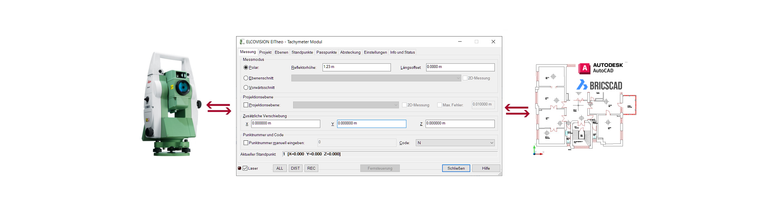
ELCOVISION 10 for Leica Viva is seamlessly integrated into AutoCAD and BricsCAD, all drawing commands automatically become measurement commands.
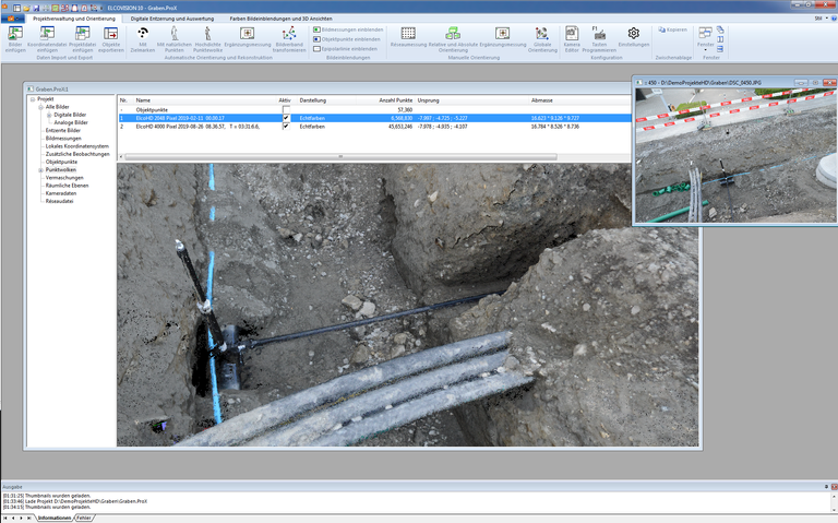
A large number of additional drawing commands additionally facilitate drawing work. As additional functions, drawings can automatically be provided with rectified textures from Leica Viva images, and drawings can also be displayed in the images. In
On-site operation
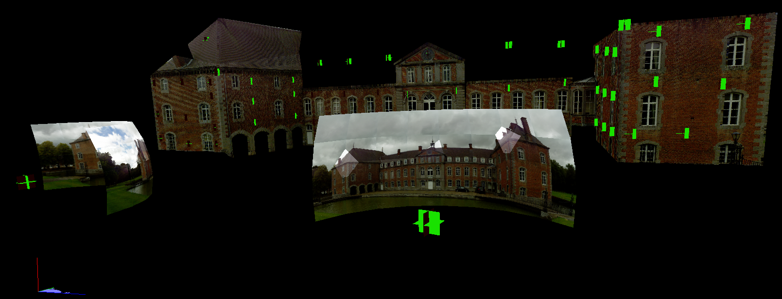
If you are planning 3D evaluations with ELCOVSION 10 for Viva, record the object from at least 2 positions with at least 75% image overlap. The panoramic image function of the Leica Viva and Nova instruments is ideally suited for this work:
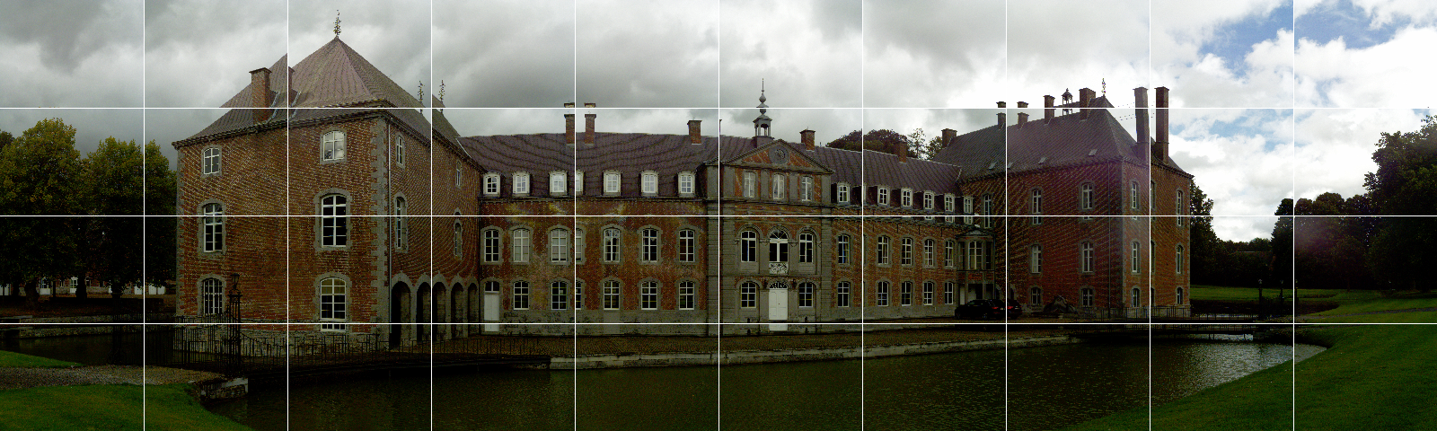
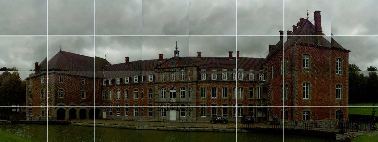
Panorama mosaic viewpoint right
Office work

Ask your local Leica sales partner for a demonstration or a temporary full version of ELCOVISION 10! Or use the demo version of ELCOVISION 10 for an initial preview, but you cannot save any results there.
ELCOVISION 10 for Leica Viva/Nova is completely integrated into AutoCAD and BricsCAD, all CAD drawing functions can be supplied with measurements plus the following functions are available:
- Superimposition of a CAD drawing into digital images
- Measuring and drawing perpendiculars with one measurement
- Measuring and drawing of 1 segment lines
- True 3D trimming of lines
- Simultaneous measurement and drawing of 3D trimmed lines
- Measure and draw 3D balanced lines
- Measurement and drawing of lines aligned with the UCS
- Arc stroke function
- Direct measurement and drawing of 3D circles and circular arcs over 3 3D points with plausibility check
- Direct measurement and drawing of 3D rectangles over 3 3D points with plausibility check
- 2D projection of a drawing on any plane
- Optimized merging of single lines to 2D polylines and 3D polylines
- Integrated 3D surface modeller
- Generate waterproof surfaces from 3D point clouds and 3D line drawings.
- Create contour lines from surface models
- Direct measurement and insertion of blocks with automatic block alignment
- Direct measurement and insertion of cylinders and cuboids
- Automatic rectification of images into the drawing
- Automatic insertion of orthophotos into the drawing
- Starting with BricsCAD V19: Direct insertion of the generated point clouds into the drawing.